There are few events in world history that make us ask ourselves: Where was I when that happened?
I still remember when the news broke about a plane crashing into the World Trade Centre in 2001 and the visuals of the giant waves hitting Indonesia and Thailand’s coast in 2004. Another shocking tragedy that affected so many of us was the tsunami hitting the nuclear power station on Fukushima’s coast. The images from these events are forever seared into memory.
It’s been a decade since the disaster took place. However, the trauma is still fresh, especially for the survivors who physically experienced the catastrophe. We had seen Chernobyl exactly 25 years before this, and with Fukushima, we once again all witnessed the horror of another nuclear accident. Like Chernobyl, hundreds and thousands of families had to be evacuated overnight as their homes were no longer safe. Nuclear radiation was spreading every minute, contaminating everything on its way.
Ten years is a long journey. Looking at the Greenpeace archives, beginning with the first team documentation from 2011 up until 2019, it reminds us that while a decade may seem like a long time, it is not enough to wash away the pains caused by the accident.
Here we present the visual documentations Greenpeace has done in Japan over the years, as we try to show the extent of radiation in various prefectures. This is Greenpeace bearing witness, so we may never forget Fukushima’s horrors and for us to continue campaigning for a truly nuclear-free world.


Radiation levels found by the Greenpeace monitoring team are far above internationally recommended limits. People living here would receive the yearly maximum dose of radioactivity within a few days.
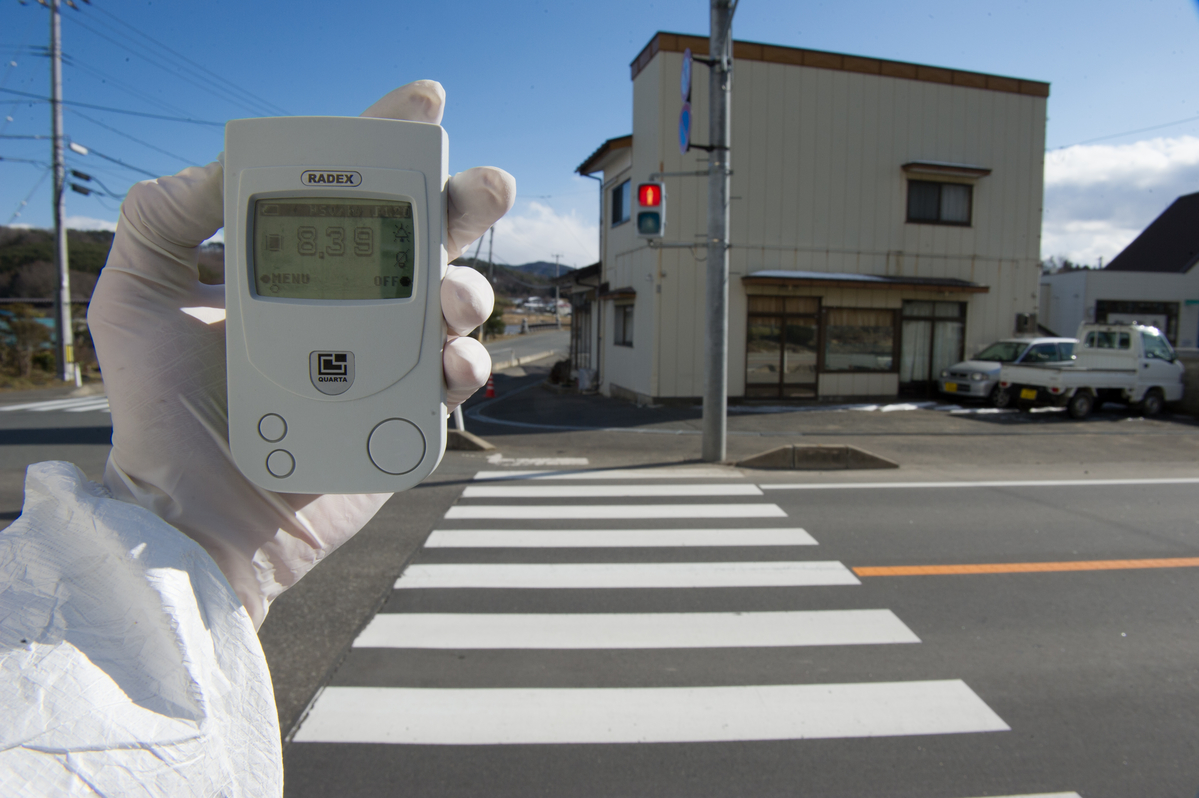
A Greenpeace team member holds a Geiger counter displaying radiation levels of 8.39 micro Sievert per hour in Iitate village, 40km northwest of the crisis-stricken Fukushima Daiichi nuclear plant, and 20km beyond the official evacuation zone.Next

As autumn approaches, leaves turn gold in a forest near Tsushima Village, in the district of Namie. Nestled in between mountains in a beautiful green valley, Tsushima lies close to the 20 km exclusion zone surrounding the Fukushima Daiichi nuclear power plant. Despite being outside the zone it is heavily contaminated, as winds blew radioactive fallout from the triple meltdown in its direction for three days. Citizens were exposed to high levels of radiation. Although the authorities had information showing this would happen, no one was warned. Thousands of the village’s inhabitants have now been evacuated and are living in temporary homes in Nihonmatsu. Whether they will be able to return to their villages remains an open question.
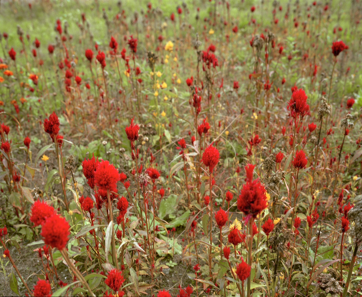
Red flowers planted by Ms Satsuki Ikeda bloom their last as autumn closes in. Ms Ikeda’s family has farmed their land in Iitate for nine generations, but she and her sons had to move away due to the contamination.Next

Using long exposure photography and a custom made, Geiger counter-enabled LED light painting tool, this project makes the invisible visible, measuring and displaying radiation levels in real-time, in the environments it exists. Inspired by the Immaterial wifi light painting project, we have sought to make environmental contamination clear and understandable using a white/orange/red lighting scale. White represents levels under 0.23uSv per hour (1mSv per year) – the Japanese government’s guideline for decontamination after Fukushima. Orange shows contamination levels elevated above this, up to 1.0uSv per hour (roughly 5mSv per year) – a range where protective measures to minimize radiation exposure (such as resettlement, decontamination, special health services, food controls, etc) should be considered. Red shows radioactivity is greater than 1.0uSv per year (upwards of 5mSv per year) – a level where protective measures to minimize radiation exposure are necessary.
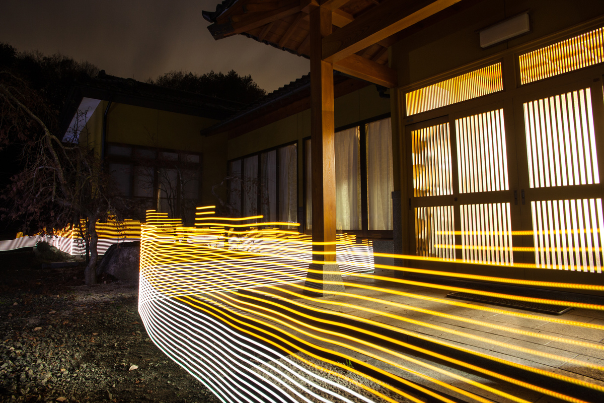
Radiation levels between 0.2uSv/h and 0.5uSv/h, with yellow showing spots elevated above the government decontamination target of 0.23 uSv/h.Next